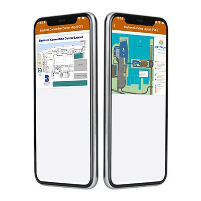


Enhance User Experience with Interactive Map Features
The map features in the conference app allow users to effortlessly access the locations of exhibitor booths. With intuitive zoom-in and zoom-out options, attendees can easily pinpoint vendor locations on the map. The option to view the map in full-screen mode provides a comprehensive overview of all exhibitor booths, ensuring a seamless navigation experience. The interactive map feature keeps your attendees on the right track, minimizing confusion and enhancing their overall event experience.

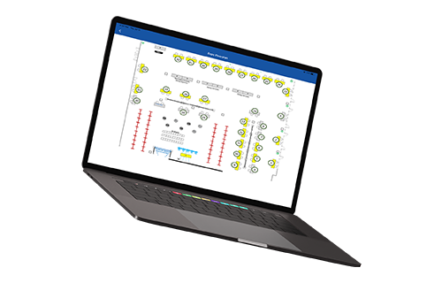
Transform Static Maps into Dynamic Navigation Tools
Bring your event to life by transforming static image maps into interactive tools. By integrating session or exhibitor information into the maps via the Content Management System (CMS), users can access detailed information with a simple tap. When an attendee taps on a booth, they receive essential details like booth number, company address, email address, website, and an email inquiry prompt. This feature not only improves user engagement but also makes it easier for attendees to bookmark individual booths and send information requests directly to exhibitors.
Improve Navigation and Exhibitor Searchability
Interactive maps are a valuable asset for any trade show or event app, offering benefits to both attendees and exhibitors. They simplify user navigation, making it easier to find specific booths and sessions. By enabling geolocation and map navigation through Grupio, you ensure that your attendees have all the tools they need to navigate the event efficiently. With interactive map features, you create a more organized, user-friendly environment that enhances the overall experience for everyone involved.